-
Baltra
 back to map
-
Bartolomé
 back to map
-
Española
 back to map
-
Fernandina
 back to map
-
Floreana
 back to map
-
Genovesa
 back to map
-
Isabela
 back to map
-
Rábida
 back to map
-
San Cristóbal
 back to map
-
Santa Cruz
 back to map
-
Santa Fé
 back to map
-
Santiago
 back to map
-
Seymour
 back to map
-
Sombrero Chino
 back to map
-
South Plaza
 back to map
Descriptions of the Galápagos Islands
Singular Lands in a Unique Place
On white-sand beaches in front of crystal clear, turquoise seas, Galápagos sea lions recline in lines as far as the eye can see. On other shores — with red, purple, golden, black, or green sands — marine iguanas and Galápagos green turtles shuttle back and forth from the waters. And on yet more forged-by-fire landscapes, mangrove lagoons and cactus forests ring with types of birdsong only heard here.
This is the Galápagos, a name that encompasses about thirteen major islands, six smaller islands, and many even tinier islets and rocks that are set along the Equator six hundred miles off the west coast of South America. They comprise 3,093 square miles of land spread out over 23,000 square miles of ocean. Born from fiery volcanoes deep in the Pacific Ocean, the islands have never been part of a continent. And since they have only relatively recently been “discovered” by humans, it’s possible to see the Earth in a more pristine state here than anywhere else on the planet.
All of the animals in the Galápagos Islands arrived by swimming, floating, or flying; and it is the prehistoric-looking Galápagos giant tortoise that became the iconic, dominant land creature. And because seasonal ocean currents that mix together here largely determine the climate, the Galápagos are one of the few places where you’ll find tropical birds, such as greater flamingos, living side by side with penguins.
This diversity of life and land — and unusual and still somewhat untouched nature — is what draws us to the islands. It’s a call you should feel good about answering, for every visitor who goes to the islands helps to maintain the Galápagos National Park, a World Heritage site.
Types of Landings: Wet and Dry
Pangas (Zodiac-type boats) cannot always make it all the way to an island’s shore because of conditions that could damage a propeller, so wet landings are sometimes necessary. A wet landing is made from as close to the beach as possible, where you will have to step out into a foot or so of water. You’ll do this by swinging your feet out over the side of the panga and then stepping into the water. You’ll reverse the procedure when you get back in the boat; sit down facing outwards and swing your feet in. You can go barefoot or wear water-sports sandals for wet landings.
For a dry landing, the panga will make its way up against a natural dock of lava rocks or a man-made dock. You may wear your shoes or hiking boots. These landings may be a bit tricky because the panga is moving with the waves, and the rocks you step on are often slippery. They usually, however, have intermittent, flat portions.
Your guide will offer you a hand as you disembark. When accepting a hand, grasp the guide’s wrist. The guide, in turn, will grasp yours in a “sailor’s grip” or wristlock. Once on the shore, place your feet carefully on the first few feet of rocks, which could be wet, depending on the tide level.
Island Descriptions
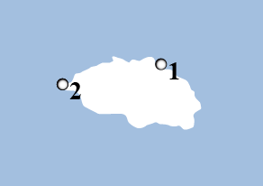
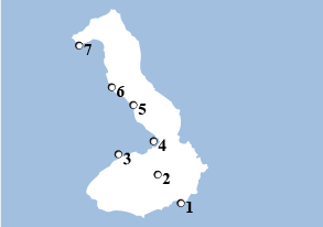
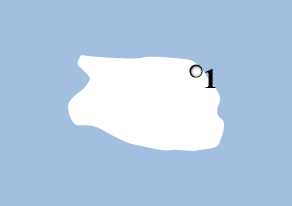
Baltra
Land Surface:
10.5 square miles
Max. Elevation:
328 feet
About:
Bordered by sheer cliffs that rise to the east, north, and south, the dry, basaltic plateau now known as the island of Baltra was once connected to Santa Cruz and Seymour Islands. Today, it is a military base and not part of the Galápagos National Park. However, it has docks and one of the two airports in the islands that receive flights from the mainland (the other airport is on San Cristóbal Island).
During World War II, Baltra was used as a United States Air Force base. Crews stationed here patrolled the Pacific for enemy submarines and protected the mouth of the Panama Canal and the sea-lanes to the south. At the end of the war, the U.S. turned the base and its airport over to the government of Ecuador. Today it is an Ecuadorian civil and military airport, as well as a naval base.
This Arid Zone island is mostly studded with prickly pear cacti and small trees. In 1934, a fortuitous event happened that saved the Baltra land iguana. In that year, members of the Hancock-Pacific Galápagos Expedition noticed that many of the iguanas on Baltra looked malnourished. Since the neighboring island of Seymour had more vegetation and no iguanas, they decided to move seventy of the reptiles from Baltra to that island as an experiment.
By 1954, feral goats on Baltra had eaten all of the vegetation edible to land iguanas; and the land iguanas became extinct on the island. In 1980 — knowing of the 1934 experiment — scientists brought a couple of iguanas from Seymour to a breeding center on Santa Cruz. Thirty-five of those iguanas’ offspring were reintroduced to Baltra in 1991. A year later, twelve more were released. By 1997, ninety-seven iguanas were found living on Baltra, thirteen of which were born on the island. By 2001, the national park reported that 420 iguanas were living and reproducing on the island. Today, land iguanas are now frequently seen in and around the Baltra Airport. Feral cats were eradicated on the island in 2003.
Baltra is now connected to the island of Santa Cruz by a ferry that daily crosses the Itabaca Channel between the islands.
Visitor Sites:
Other than the airport, there are no visitor sites or services available on Baltra.
Wildlife to Look For:
- Brown pelican
- Brown noddy
- Galápagos leaf-toed gecko
- Galápagos sea lion
- Land iguana
- Lava gull
- Lava lizard
- Magnificent frigatebird
- Small ground finch
- Yellow warbler
Plants to Look For:
- Palo santo
- Prickly pear cactus
- Saltbush
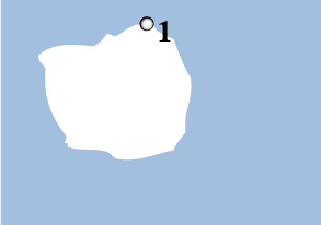
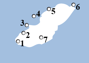
Bartolomé
Land Surface:
0.46 square miles
Max. Elevation:
374 feet
About:
If you’ve ever wondered what it would be like to visit the moon, Bartolomé might just provide you with the answer.
An extinct volcano, Bartolomé Island appears to be geology in its purest form: The island is dotted with craters, cinder cones, lava flows, spatter cones, and broken lava tunnels which run down from the summit. And just offshore is Pinnacle Rock, the tuff cone that is probably the most famous (and most photographed) landmark in the Galápagos.
Although at first glance, words that describe a moonscape — such as barren and desolate — might come to mind, Bartolomé supports a starkly beautiful complex of life. Some Arid and Littoral Zone plants have taken hold. On the slopes of the volcano, low-to-the-ground gray matplant thrives in the volcanic sand; and spurge, which forms a small tuft of green with tiny, white flowers, pushes up. Endemic lava cacti adorn some of the older lava.
By climbing the 375 wooden steps to the top of the island, you’ll gain an impressive, panoramic view of this truly special, volcanic place and the isthmus of Bartolomé, which is covered by luxuriant green mangroves and bordered by two, half-moon-shaped coves of golden sand. You’ll get a spectacular look at Pinnacle Rock, which stands like a giant rhinoceros horn shooting up from the sea. At its foot is a beach for swimmers and snorkelers and a small colony of Galápagos penguins.
Pinnacle Rock was partially bombed by American pilots during World War II.
Visitor Sites:
1) Pinnacle Rock: Pinnacle Rock is an eroded volcanic formation that juts from the sea like an obsidian knife. It is truly an iconic site and is one of the best-known and most photographed sites in the islands. After landing on the beach adjacent to the rock, visitors can swim with colorful fish, sea lions, Galápagos penguins and can swim and snorkel around the rock itself. A short trail leads to a beach to the south where swimming is prohibited, though you may see stingrays, spotted eagle rays and black tipped sharks. The northern beach is a nesting site for green sea turtles from January to March. Landing: Dry. Difficulty: Easy.
2) Isla Bartolomé: After landing in a small bay, opposite Pinnacle Rock, visitors climb an 1800-foot trail to the 600-foot summit of the island. Much of the trail is a wooden staircase, built to prevent erosion. Along the way, you will notice many interesting volcanic formations including spatter and tuft cones and lava flows. The summit provides stunning views of Pinnacle Rock, Sullivan Bay, and Daphne Major and Minor. Landing: Dry. Difficulty: Moderate/Difficult.
Wildlife to Look For:
- Brown pelican
- Galápagos green turtle
- Galápagos hawk
- Galápagos penguin
- Ghost crab
- Lava heron
- Whitetip reef shark
Plants to Look For:
- Beach morning glory
- Gray matplant
- Lava cactus
- Mollugo
- Prickly pear cactus
- Red mangrove
- Saltbush
- Spiny bush
- Spurge
- White mangrove
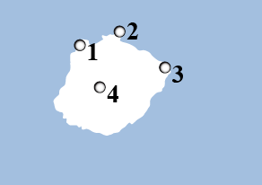
Española
Land Surface:
23 square miles
Max. Elevation:
676 feet
About:
Washed by surf and spray and bordered by steep cliffs, Española is probably the Galápagos you envisioned when you decided to make the trip to the islands. As the southernmost island in the archipelago, Española’s relative isolation has resulted in not only an abundance of unusual wildlife, but species and subspecies that are endemic to the island itself, such as the Española (Hood) mockingbird, the Española (Hood) racer snake, the Española (Hood) lava lizard, the waved albatross, and the island’s brightly colored marine iguanas.
Along with this rich faunal life, the vegetation on Española is a blend of Littoral, Arid, and Transition Zone plants. Galápagos carpetweed and spiny shrubs, such as Galápagos lantana, bump up against each other here. Intertidal life bursts with green and pencil-spined sea urchins, angelfish, and sea anemones.
The waved albatross almost exclusively nests and rears young on Española between mid-April and December. The whole, south coast of the island is a low cliff. The updraft along this cliff, which is caused by the southeast trade winds, enables the birds to take off with relative ease.
Blue-footed boobies and Nazca boobies are inland or along the cliffs all year-round, and you may witness them “dance” during their courting rituals or watch them tend their chicks. The Española mockingbird will perch on your towel or backpack, searching for water. American oystercatchers, Galápagos doves, Galápagos hawks, large cactus finches, lava herons, lava lizards, marine iguanas, small ground finches, snakes, swallow-tailed gulls,' warbler finches, and yellow-crowned night herons all make their livings here. The lava lizards on Española are particularly large and colorful; the female’s red throat is especially pronounced.
At the western tip of the island, there’s a “blowhole” where the ocean rushes violently under the lava bedrock and then is ejected thunderously upward through a fissure. A vaporous plume of water shoots more than eighty feet into the air, in a Galápagos-style geyser.
At 3.4 million years, Española is the oldest of the Galápagos Islands. With its breadth of one-of-a-kind wildlife and plant species, it truly embodies the spirit of the Islas Encantadas.
Visitor Sites:
1) Gardner Bay: With an expansive white sand beach (one of the longest in the Galápagos), Gardner Bay is popular with tourists and sea lions alike. There is no trail here, so the main activities are wandering the tranquil beach and snorkeling and swimming. Three species of Darwin’s Finches and Española Mockingbirds (the only carnivorous mockingbird species) can be spotted here. From January to March, Green Sea Turtles can be found nesting on the beach. Landing: Wet. Difficulty: Easy.
2) Punta Suarez: As you land at Punta Suarez on the western tip of the island, you may see young sea lions surfing the waves and colorful marine iguanas basking in the sun. Blue-footed and Nazca boobies nest just inland. A two-mile hike leads visitors past colorful Española lava lizards to the cliffs and the famous blowhole, which spurts water over twenty feet into the air at high tide. Between April and December, the world’s entire population of adult waved albatrosses (between 25,00 and 30,000 individuals) can be found nesting here. They mate for life and perform an elaborate mating dance that includes stumbling, honking, and beak-fencing. Landing: Dry. Difficulty: Moderate/Difficult.
Wildlife to Look For:
- American oystercatcher
- Blue-footed booby
- Española (Hood) lava lizard
- Española (Hood) mockingbird
- Española (Hood) racer snake
- Galápagos dove
- Galápagos green turtle
- Galápagos hawk
- Galápagos sea lion
- Ghost crab
- Green sea urchin
- King angelfish
- Large cactus finch
- Lava heron
- Marine iguana
- Nazca booby
- Pencil-spined sea urchin
- Red-billed tropicbird
- Sally Lightfoot crab
- Small ground finch
- Swallow-tailed gull
- Wandering tattler
- Warbler finch
- Waved albatross
Plants to Look For:
- Beach dropseed
- Beach morning glory
- Desert plum
- Desert thorn
- Galápagos carpetweed
- Galápagos lantana
- Galápagos shore petunia
- Horse purslane
- Mesquite
- Palo verde
- Saltbush
- Salt sage
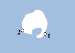
Fernandina
Land Surface:
249 square miles
Max. Elevation:
4,900 feet
About:
If stepping onto Baltra is like standing on the moon, visiting Fernandina is like seeing the Earth when it was brand-new.
The most westerly of the Galápagos Islands, Fernandina is the youngest and most active volcanically, with eruptions occurring from its single volcano, La Cumbre, every few years. Lava fields extend from La Cumbre’s base to the ocean, and both types of flows — `a`a and pahoehoe — can be seen. Fernandina is literally land-in-the-making.
Being so young, Fernandina is also one of the most pristine islands. Here, flightless cormorants build their nests, and Galápagos sea lions play in the tide pools. At Punta Espinosa, a narrow stretch of land on the northeast that faces Isabela Island, you may walk on lava rocks amid thousands of stacked marine iguanas; and watch Galápagos penguins swim and large flocks of blue-footed boobies fish just offshore. Whales and dolphins may be seen in the water beyond them, while the nearby mangroves provide a habitat for yellow warblers, a variety of herons, and possibly the mangrove finch.
Visitor Sites:
1) Punta Espinosa: Here you may see some of the most unique Galápagos species: flightless cormorants, Galápagos hawks, Galápagos penguins,and the largest colony of marine iguanas in the islands. In 1994, Punta Espinosa was raised between two and three feet by tectonic uplift, leaving the landing dock inaccessible except at high tide. Landing: Dry. Difficulty: Moderate.
Wildlife to Look For:
- American oystercatcher
- Banded Galápagos snake
- Blue-footed booby
- Flightless cormorant
- Galápagos green turtle
- Galápagos hawk
- Galápagos mockingbird
- Galápagos penguin
- Galápagos racer snake
- Galápagos sea lion
- Lava lizard
- Mangrove finch
- Marine iguana
- Medium ground finch
- Sally Lightfoot crab
- Small ground finch
- Yellow warbler
Plants to Look For:
- Black mangrove
- Galápagos shore petunia
- Lava cactus
- Red mangrove
- Saltbush
- White mangrove
Floreana
Land Surface:
67 square miles
Max. Elevation:
2,100 feet
About Floreana:
Best known for its colorful history, Floreana has seen the footsteps of buccaneers, pirates, whalers, convicts, and colonists on its shores. Because of a small spring that bubbles up from underground (which occasionally dries up) and a nutrient-rich soil, it was a haven for the early pirates and whalers in the seventeenth and eighteenth centuries — and later for more permanent residents. In fact, Floreana has been continuously inhabited since the mid 1800s and was the first of the Galápagos Islands to support a permanent human population.
In the late 1700s, British whalers set up a “post office” barrel for letters to and from England. The crew of inbound ships would deposit mail in the barrel that outbound whalers would pick up. Today, the practice continues, and you are invited to drop off a postcard or two and sift through the mail for any letters that you can hand-deliver or post when you get back home. Now known as “Post Office Bay,” the site was also the location of a 1926 Norwegian fish-canning factory that closed within two years. Situated behind the famous post office barrel is a lava tunnel, along with a Galápagos sea lion rookery.
At the northern tip of the island is Punta Cormorant, with its two, highly contrasting beaches. The landing beach has olive-green sand, the result of olivine crystals — volcanically produced silicates of magnesium and iron. At the end of a short trail is a carbonate beach of extremely fine, white sand known as “Flour Sand Beach.” Formed by the erosion of coral skeletons, this beach is a nesting site for Galápagos green turtles.
Between these two beaches is a salt lagoon frequented by long-legged greater flamingoes, white-cheeked pintail ducks, stilts, and other shorebirds.
Just off Punta Cormorant is a “marine visitor site” (landings are not allowed) called Devil’s Crown. Almost completely submerged, Devil’s Crown is a volcanic crater that has been transformed by erosion into a semicircle of a few, rocky spikes protruding above the water; thus, it truly looks like a headpiece for Old Scratch. It’s a popular roosting site for seabirds such as blue-footed boobies, brown pelicans, and frigatebirds; and it is a nesting place for red-billed tropicbirds. The center of the crown is an outstanding snorkeling spot, full of colorful fish.
Unfortunately, because of Floreana’s human history, it has suffered from our folly and our introduced species. Its giant tortoise subspecies is now extinct due to the pirates and whalers who, scientists estimate, removed as many as two hundred thousand of them from the Galápagos Islands during the nineteenth century for their meat. Early visitors also introduced rats that ate the eggs and hatchlings. By 1840, the giant tortoises of Floreana were gone.
Several species of plants are unique to Floreana, but wild goats took their toll. The goats and some other invasive herbivores were completely removed by the Galápagos National Park Service in 2007. Today, conservation work is focused on restoring healthy populations of fauna such as Galápagos hawks, Galápagos racer snakes, and the Floreana mockingbird. Now extinct on the main island of Floreana, the Floreana mockingbird can only be found in two tiny populations on two, small satellite islands off the coast of Floreana.
An ongoing conservation program works to educate the local human population on sustainable methods of agriculture, solid waste management, and collecting and filtering drinking water. Floreana’s unique human history, geology, and wildlife make for a fascinating island.
Visitor Sites:
1) Post Office Bay: In the eighteenth century, a group of whalers set up a wooden barrel to collect mail at this site, now known as Post Office Bay. A trail behind the barrel leads through palo santo and palo verde trees to a cave, which is actually a lava tube running down to the sea. Landing: Wet. Difficulty: Easy.
2) Punta Cormorant: Between two tuff cones, the Punta Cormorant landing is on a beach with green, olivine sand. Trails allow you to explore a brackish lagoon where greater flamingoes wade through the water, sifting shrimp with their curved bills. Stingrays can be seen in the shallows. You may also see pintail ducks, stilts, large-billed flycatchers, and several species of finches. Landing: Wet. Difficulty: Easy.
3) Devil’s Crown: Devil’s Crown is a volcanic crater that has been eroded by waves. The inside of the “crown” is a perfect environment for coral, which attracts other marine life; making this one of the best snorkeling sites in the Galápagos. You may see sea lions, sharks, rays, tropical fish, eels and sea turtles. The outside of the crown is a haven for birds including boobies, pelicans, frigatebirds, and red-billed tropicbirds. Type of Landing: None. Difficulty: Moderate/difficult
4) Highlands: Cerro Alieri and Asilo de la Paz: There are two visitor sites in highlands of Floreana. Both are located at the base of Asilo de la Paz, a 300-foot volcanic cone. Cerro Alieri is about a 15-minute drive from Puerto Velasco Ibarra. Armchair botanists will enjoy learning about the 48 species of plants that have been identified here, 56% of which are native and 33% of which are endemic. In addition, this is the site of a major conservation program for a critically endangered plant, Linum cratericola, which was believed extinct until scientists and park wardens reencountered it in 1997. Asilo de la Paz is about a 45-minute ride from town. Here, you may view a pirate cave and the freshwater spring that is the island’s main water source. A nearby corral, built by the national park service, contains giant tortoises from various islands. Landing: None. Difficulty: Easy.
Wildlife to Look For:
- Azure parrotfish
- Bicolor parrotfish
- Blue-footed booby
- Black-necked stilt
- Brown pelican
- Brown noddy
- Bumphead parrotfish
- Dark-billed cuckoo
- Floreana lava lizard
- Galápagos flycatcher
- Galápagos green turtle
- Galápagos hermit crab
- Galápagos penguin
- Galápagos sea lion
- Ghost crab
- Great frigatebird
- Greater flamingo
- Hammerhead shark
- Large ground finch
- Magnificent frigatebird
- Medium ground finch
- Pencil-spined sea urchin
- Red-billed tropicbird
- Ruddy turnstone
- Sanderling
- Semipalmated plover
- Small ground finch
- Stingray
- Western sandpiper
- Whimbrel
- White-cheeked pintail duck
- Willet
- Wilson’s phalarope
- Yellow warbler
- Yellow-tailed surgeon fish
Plants to Look For:
- Beach morning glory
- Bitterbush
- Black mangrove
- Button mangrove
- Cut-leafed daisy
- Floreana daisy
- Galápagos clubleaf
- Galápagos cotton
- Galápagos croton
- Galápagos lantana
- Galápagos milkwort
- Galápagos passion flower
- Ink berry
- Leatherleaf
- Longhaired scalesia
- Mesquite
- Morning glory
- Palo santo
- Palo verde
- Pearl berry
- Saltbush
- Spiny bush
Genovesa
Land Surface:
5.4 square miles
Max. Elevation:
250 feet
About:
Less than half a degree north of the Equator, Genovesa is often referred to as “Bird Island” for the vast numbers of pelagic seabirds that come here to nest. Great frigatebirds, red-footed boobies, swallow-tailed gulls, and storm petrels all breed here by the thousands. However, there are no land reptiles — with the exception of some very small marine iguanas. This is due to the direction of the ocean currents, which couldn’t carry the terrestrial animals here.
The island itself is a low, shield volcano barely breaking the surface of the ocean. Ships sail directly into its large, breached caldera to anchor.
At Darwin’s Bay, one of two visitor sites on the island, the landing point is a small, white, coral-sand beach. Galápagos sea lions come here to swim; and red-footed boobies, Nazca boobies, and great frigatebirds nest throughout the year in the saltbushes nearby.
Once past the beach, you’ll find tidal lagoons with lava gulls and yellow-crowned night herons. Above on the cliff, swallow-tailed gulls lay big, speckled eggs in nests made of white coral pieces and black volcanic gravel. Red-footed boobies and frigates hover, taking advantage of the rising winds. Near the end of this walk, thousands of storm petrels flutter at the cliff’s edge, where they nest in crevices. Short-eared owls can sometimes be seen, hunting the storm petrels during daylight hours.
Prince Philip’s Steps, the second of the two landing sites, was given its name after the visit of Prince Philip of the United Kingdom in the 1960s, which helped stimulate international interest in the survival of the Galápagos. The site, south of Darwin Bay, is on the top of a cliff. On the panga ride to the dry landing on the rocks below, you may meet some Galápagos fur seals.
After negotiating the steps, you’ll enter an Arid Zone forest of low palo santos, where great frigatebirds drape themselves in the trees and Nazca boobies nest on the ground. The trail, which is on top of an old pahoehoe lava flow, then heads inland to the east coast where hot, fluid lava once flowed into a fracture, leaving a big crack. Standing here, you’ll be surrounded by a cloud of Galápagos storm petrels, which nest in large numbers in the crevices and lava tubes. This same colony is occupied at night by Madeiran storm petrels. Well-camouflaged short-eared owls hide in the crack so they can launch attacks on the other birds.
Due to its remote location and lack of freshwater, Genovesa remains almost unaltered; there are no introduced species on the island.
Visitor Sites:
1) El Barranco: El Barranco is notable for its variety and abundance of birdlife including red-footed and Nazca boobies, short-eared owls, red-billed tropicbirds, Galápagos swallows and Galápagos doves. Upon landing on a steep rocky stairway, visitors are treated to the site of small fur seal colony and a variety of marine life clinging to the rocks. There is a hike (just under a mile) to a plateau that leads through a Palo Santo forest where you will pass nesting booby colonies. There are some great views of lava plains near the end of the trail. Keep an eye out for wedge-rumped storm petrels. Landing: Dry (with slippery rocks). Difficulty: Moderate.
2) Darwin Bay: After landing on a white-sand, coral beach, you may embark upon a hike along a short trail (one half mile) that meanders through mangroves, where a variety of land birds may be spotted, to the tidal pools where sea lions are often found frolicking, and up a rocky hill that leads to a point overlooking the cliffs and Darwin Bay. This is one of the few places in the islands where you are pretty much guaranteed to see red-footed boobies and you may see white-cheeked pintail ducks, gulls, and herons feeding near the shores of the tidal lagoon. Landing: Wet. Difficulty: Easy/Moderate.
Wildlife to Look For:
- Band-rumped storm petrel
- Brown noddy
- Galápagos dove
- Galápagos fur seal
- Galápagos green turtle
- Galápagos mockingbird
- Galápagos sea lion
- Galápagos shearwater
- Galápagos storm petrel
- Great frigatebird
- Hammerhead shark
- Large cactus finch
- Large ground finch
- Lava gull
- Lava heron
- Madeiran storm petrel
- Marine iguana
- Nazca booby
- Red-billed tropicbird
- Red-footed booby
- Sharp-beaked ground finch
- Short-eared owl
- Swallow-tailed gull
- Wandering tattler
- Warbler finch
- Wedge-rumped storm petrel
- Whimbrel
- White-cheeked pintail duck
- Yellow-crowned night heron
- Yellow warbler
Plants to Look For:
- Galápagos croton
- Galápagos shore petunia
- Lava cactus
- Morning glory
- Muyuyo
- Palo santo
- Prickly pear cactus
- Red mangrove
- Saltbush
- Scorpion weed
- Spurge
Isabela
Land Surface:
1,771 square miles
Max. Elevation:
5,600 feet
About:
Isabela is the largest of the Galápagos Islands, with more than half of the land surface area in the archipelago. It is made up of six volcanoes (Alcedo; Cerro Azul; Darwin; Sierra Negra; Wolf, which has the highest summit in the Galápagos at an elevation of 5,600 feet; and Ecuador, an extinct volcano that has been destroyed by erosion and wave action) that are joined by extensive lava flows. Along with Fernandina Island, it is one of the most volcanically active spots on earth. The Equator passes through both Ecuador and Wolf Volcanoes.
Puerto Villamil, situated on the south side of Sierra Negra Volcano, is the main settlement on the island. The town hosts a Tortoise Breeding Center run by the national park service. Originally a penal colony in the nineteenth century, Puerto Villamil is the site of the Muro de las Lagrimas (Wall of Tears), which was built from giant lava blocks by the convicts. The prison finally closed in the late 1950s.
There are many brackish lagoons close to the town harbor that draw a wide range of coastal birds and seabirds. The lagoon at Quinta Playa to the west of Villamil has the largest concentration of greater flamingos in the islands.
More wild giant tortoises live on Isabela than on any other island in the Galápagos. Isabela’s large size and volcanic topography created barriers for the slow-moving reptiles; they were unable to cross the lava flows, causing several different sub-species of tortoise to develop. Today, Galápagos giant tortoises roam free in the calderas of Alcedo, Cerro Azul, Darwin, Sierra Negra, and Wolf Volcanoes.
The Sierra Negra Volcano at the southeastern end of Isabela has the largest caldera in diameter of any in the Galápagos, measuring about six miles. Chico Volcano on the northeast side of the caldera is an area of high fumarolic activity; and to the west is the “Mina de Azufre” or sulfur mine, where more fumarolic activity and sulfur deposits are found. Lava from an eruption in November 2005 on the north side of the caldera rim flowed all around the eastern and southern edges; and today Moist Zone vegetation covers the area where up to seven species of Darwin’s finches live.
At Punta Moreno on the western shore of the island, brackish water ponds and crystal tide pools indent the large field where a pahoehoe lava surface has collapsed into the lava tubes beneath. Mangroves surround some of these water bodies. A wealth of animal and plant life can be found here, including greater flamingos, white-cheeked pintail ducks, waders, and scores of invertebrates. Within and along the mangroves on the coast, brown pelicans, flightless cormorants, Galápagos penguins, great blue herons, and several types of rays may be discovered.
At the foot of Alcedo Volcano is Urvina Bay, where land and marine iguanas (some of the largest in the islands), hermit crabs, and Galápagos giant tortoises wander through a variety of Littoral and Arid Zone plants. In 1954, the whole area was raised by tectonic action — up to fifteen feet in places. This uplifting was followed by an eruption of Alcedo a few weeks later. A further uplift of almost three feet took place in 1994, which resulted in the coastline being driven three-quarters of a mile farther out to sea and the landing dock being unusable except at high tide. Today, you can still find signs of the underwater origin of this new land: shells, pebbles, sea urchin segments, and pumice — a light and buoyant volcanic material that covers Alcedo’s slopes. Some coral skeletons here reach up waist-high.
On the rim and inside the caldera of Alcedo, thousands of tortoises gather during the hot/rainy season to wallow in muddy pools, which rehydrates them and protects them from ticks. With estimates at five thousand individuals, the Alcedo tortoise population is the most flourishing in the Galápagos. In the garúa season, the tortoises hide in the bushes on the rim of the crater or dig a burrow to escape the fierce sun.
An anchorage long used by pirates and whalers, the narrow channel of Tagus Cove on the west coast of Isabela is a flooded valley between two large tuff cones. To arrive here, your boat will cruise through the Bolivar Channel, where the coldest, most productive waters in the Galápagos are found. The upwelling of the nutrient-rich Cromwell Current makes the channel one of the best places to see whales in the Galápagos. Some sixteen species have been identified here, including humpback, minke, orca, sei, and sperm. During the nineteenth century, whalers almost caused the extinction of these cetaceans. The steep cliffs of Tagus Cove still bear graffiti inscriptions of the names of many of the ships that once prowled these seas.
Behind the tuff formations bordering the cove is a wooden stairway that climbs up to a viewpoint where you can see Darwin Lake, a perfectly round, saltwater crater that has been elevated above sea level by tectonic uplift. White palo santos around the lake turn green during the hot/rainy season, and Darwin’s finches seem to swarm everywhere. The trail then climbs inland to a promontory formed by spatter cones. The site provides spectacular views back towards the anchorage in the bay, as well as of Darwin Volcano and Wolf Volcano farther north.
A panga ride in Tagus Cove’s quiet waters often uncovers blue-footed boobies, brown noddies, and brown pelicans making their nests; and flightless cormorants and Galápagos penguins occupying the lava ledges.
Visitor Sites:
1) Puerto Villamil: The quiet, laidback town of Puerto Villamil is the main settlement on the island. The nearby beach and lagoons are the perhaps the best places in the archipelago to view migratory birds. Black-necked stilts and flamingoes are two of the most common resident species. You can reach several visitor sites from town, including:
- Tortoise Center: There is a one-mile interpretive trail that leads from town, goes past the lagoons, and ends at the Tortoise Center, which houses tortoises from the populations of southern Isabela.
- Wall of Tears is a 3.5-mile walk (one-way) from town. The wall was built by convicts at the penal colony that operated on the island in the 1940s and 1950s. The wall is 15 to 18-feet high, nine-feet wide and 300-feet long.
- Tintoreras is a group of small islets off the coast that are only accessible by boat. You may spot sea lions, sea turtles, marine iguanas, rays, and other species in the tranquil waters of the bay.
2) Sierra Negra Volcano: Sierra Negra’s caldera measures six-miles across from north to south and nine-miles across from east to west, making it the second largest caldera in the world! It is a 45-minute drive from Villamil, followed by several hours of walking or horseback riding. On the rim of the volcano, the trail divides into two: to the west, it heads to Mina de Azufre, an old sulfur mine; toward the east, the trail leads to Chico Volcano. The endemic narrow-leafed Darwin bush is found only around the rims of Sierra Negra and Cerro Azul. Landing: None. Difficulty: Very Difficult.
3) Punta Moreno: The trail here crosses a large pahoehoe lava flow, dotted by numerous green lagoons, where flamingoes, paint-bill crakes, white-cheeked pintails and common gallinules can be seen. This young lava flow is in the process of being colonized by several species of interesting pioneer plants. Landing: Dry. Difficulty: Moderate/Difficult.
4) Elizabeth Bay: No visitors are allowed on land here, but a panga tour around the bay and adjacent lagoons may reveal Galápagos green turtles, golden cownose rays, spotted eagle rays, and white-tip reef sharks. Galápagos penguins prefer the rocky islets, and marine iguanas enjoy the plentiful algae. Other species seen here include flightless cormorants, pelicans and lava herons. Landing: None (though snorkeling is permitted). Difficulty: Easy.
5) Urvina Bay: A trail leads away from the beach and into the arid zone of the island. Here you may encounter large land and marine iguanas and giant tortoises. Closer to the water you may see flightless cormorants. The most unique feature here is the miles-long stretch of coral reef jutting into the air - a result of a major uplift in 1954. Landing: Wet. Difficulty: Easy/Moderate.
6) Tagus Cove: Early pirates and whalers frequented Tagus Cove and some even wrote their names on the cliffs along the shore. A short steep hike leads to Darwin Lake, which is comprised of salt water and lies within a tuff cone. It is a good place to spot a variety of land birds such as ground and tree finches, hawks, yellow warblers, large-billed flycatchers and, occasionally, woodpecker finches. A panga ride along the cliffs may reveal flightless cormorants, Galápagos penguins, and Galápagos sea lions. Landing: Dry, with slippery rocks. Difficulty: Moderate/Difficult.
7) Punta Vicente Roca: At Punta Vicente Roca in the north, remnants of an ancient volcano form two turquoise coves with a bay that is well protected from ocean swells. This is a popular anchorage from which to take panga rides along the cliffs that are the volcano’s remains or to explore a partially sunken cave at the water’s edge. Blue-footed and Nazca boobies perch along the sheer walls, while flightless cormorants inhabit the shoreline. Landing: None: Difficulty: Easy.
Wildlife to Look For:
- American oystercatcher
- Black-necked stilt
- Blue-winged teal
- Brown pelican
- Common gallinule
- Flightless cormorant
- Franklin’s gull
- Galápagos giant tortoise
- Galápagos green turtle
- Galápagos hawk
- Galápagos penguin
- Galápagos sea lion
- Golden cownose ray
- Great blue heron
- Greater flamingo
- Land iguana
- Large tree finch
- Laughing gull
- Lava gull
- Lava heron
- Lava lizard
- Marine iguana
- Medium ground finch
- Paint-billed crake
- Pied-billed grebe
- Ruddy turnstone
- Sally Lightfoot crab
- Semi-terrestrial hermit crab
- Short-eared owl
- Small ground finch
- Small tree finch
- Spotted eagle ray
- Striated heron
- Vegetarian finch
- Wandering tattler
- Warbler finch
- Whimbrel
- White-cheeked pintail duck
- White sea urchin
- Whitetip reef shark
- Woodpecker finch
- Yellow-crowned night heron
- Yellow warbler
Plants to Look For:
- Acacia
- Beach morning glory
- Bitterbush
- Black mangrove
- Button mangrove
- Candelabra cactus
- Common carpetweed
- Galápagos cotton
- Galápagos croton
- Galápagos lantana
- Galápagos shore petunia
- Galápagos tomato
- Guayabillo
- Heart-leafed scalesia
- Lava cactus
- Mesquite
- Mollugo
- Muyuyo
- Narrow-leafed Darwin bush
- Needle-leafed daisy
- Palo santo
- Palo verde
- Pega pega
- Poison apple
- Prickly pear cactus
- Radiate-headed scalesia
- Red mangrove
- Red-haired tournefortia
- Saltbush
- Spiny bush
- White mangrove
- White-haired tournefortia
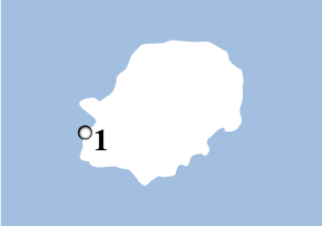
Rábida
Land Surface:
1.9 square miles
Max. Elevation:
1,204 feet
About:
Often called the geographic center of the Galápagos archipelago, Rábida — just south of Santiago — is predominantly composed of scoria, a particulate material created when hot lava meets seawater. Scoria has a high iron content, giving the island a red color. Rábida’s single volcano is extinct, but it left behind a legacy: a spectacle of tall, red cliffs and a red-sand beach; which when played against the teal waters, makes this island visually stunning.
On these red sands, marine iguanas and a noisy colony of Galápagos sea lions attempt to rest in the shade of nearby caves. Brown pelicans make homes by the beach in saltbushes. Behind the beach is a lagoon where wading birds and white-cheeked pintail ducks feed.
A short trail inland leads through Littoral and Arid Zone plants, such as palo santos, prickly pear cacti, and spiny bushes. Galápagos doves, Galápagos mockingbirds, yellow warblers, and several species of Darwin’s finches flitter in the vegetation, while blue-footed boobies and Nazca boobies linger in the cliffs.
Unfortunately, introduced goats led to the extinction of several native species on the island, including geckos, land iguanas, and rice rats. In 1971, however, the Galápagos National Park Service successfully eradicated goats from Rábida, causing the island to bloom with diversified biota again.
Visitor Sites:
1) There is one landing site on Rábida. It is described above. Snorkel along the rocks at the east end of the beach to encounter scores of near-shore and pelagic fish. Landing: Wet. Difficulty: Easy/Moderate.
Wildlife to Look For:
- Black-necked stilt
- Blue-footed booby
- Brown noddy
- Brown pelican
- Cactus finch
- Galápagos dove
- Galápagos fur seal
- Galápagos hawk
- Galápagos mockingbird
- Galápagos penguin
- Galápagos sea lion
- Great blue heron
- Large ground finch
- Lava lizard
- Manta ray
- Marine iguana
- Medium ground finch
- Nazca booby
- Small ground finch
- Small tree finch
- Vegetarian finch
- Warbler finch
- Wandering tattler
- White-cheeked pintail duck
- Woodpecker finch
- Yellow warbler
Plants to Look For:
- Black mangrove
- Galápagos croton
- Galápagos milkwort
- Galápagos tomato
- Leatherleaf
- Muyuyo
- Palo santo
- Prickly pear cactus
- Saltbush
- Spiny bush
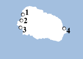
San Cristóbal
Land Surface:
215 square miles
Max. Elevation:
2,395 feet
About:
San Cristóbal is the easternmost and one of the oldest islands in the Galápagos, with eroded volcanic peaks in the north and densely vegetated slopes in the south.
The provincial capital of the Galápagos, Puerto Baquerizo Moreno, lies at the head of Wreck Bay at the southwest tip of the island. One of the archipelago’s two airports is here (the other is on Baltra Island ).
Puerto Baquerizo Moreno has become a hotspot for surfing among South Americans. The waves are best at the beginning of the hot/rainy season, when a wet suit is not required to keep warm. Surfers can be seen at Tango Reef, west of town.
In 1998, the Galápagos National Park Service opened the San Cristóbal Interpretation Center here, giving visitors the opportunity to learn more about the plants, ecosystems, wildlife, and human history of the archipelago.
San Cristóbal is the only island in the Galápagos with permanent freshwater, held in a small lake named El Junco near the top of the island. Because of this availability of water, the island was settled early in Galápagos history. In fact, Charles Darwin’s first stop in the Galápagos was on San Cristóbal in 1835 when the island was the home of the archipelago’s governor.
In the mid 1800s, the small, farming community of El Progresso was a penal colony for criminals from Ecuador. It was later taken over by Manuel Cobos, who treated the convicts as slave laborers. During an insurrection, the convicts murdered Cobos.
On the eastern side of the island is Punta Pitt, an unusual place carved from the tuff formations of an ancient volcano and graced with a green-sand beach. This is the only place in the islands where you can see all three species of boobies nesting — blue-footed, Nazca, and red-footed. An endemic species of lava lizard also makes its tracks on the olivine crystals.
Just inland behind the beach, saltbushes and spiny bushes give way to a mini-canyon where you may climb a hill for a panoramic view. The trail draws a half moon around Punta Pitt, goes over a pass, and makes its way downhill and south to a stand of palo santos, where frigatebirds nest. Muyuyos often cradle the nests of red-footed boobies, while blue-footed boobies scrape out a place on the ground. In the dry season, Galápagos carpetweed colors the canyon red.
A short ride or a half-hour’s walk beyond the airport is Lobería Beach. Tide pools offer the pups of a large Galápagos sea lion colony a place to learn and practice swimming and fishing techniques. The mammals share the beach with marine iguanas.
A forty-five minute drive over the top of the island will take you to the Galapaguera Tortoise Reserve, which was established to preserve the San Cristóbal subspecies of giant tortoise. San Cristóbal originally had two populations of Galápagos giant tortoises: one in the northeast, consisting of approximately 1,400 individuals; and one in the south in an area adjacent to the current preserve, which became extinct.
Within the large walls of Galapaguera, tortoises are free to roam, and you may try to spot them as you travel along the boardwalks and gravel trails. Not only can you commune with these gentle giants, but you may spot flycatchers, yellow warblers, some species of Darwin’s finches, and the endemic San Cristóbal (Chatham) mockingbird, found only on this island.
On your way to or from San Cristóbal, your cruise boat will take you on a spectacular ride around Kicker Rock (or León Dormido). Rising five hundred feet straight up from the ocean, this “sleeping lion” is the remnant of a vertical tuff cone. There is a split in Kicker Rock, allowing the sun to set between its towering vertical walls into the waters of its narrow channel. Blue-footed boobies, Nazca boobies, and frigatebirds fly along the staggering cliffs, while Galápagos sea lions haul out along the shore.
Visitor Sites:
1) San Cristóbal Interpretation Center: The center, which is just outside of the town of Puerto Baquerizo Moreno, was opened in 1998 and features exhibits showcasing the natural and human history of the Galápagos and the ongoing efforts to preserve and protect the islands. Landing: None. Difficulty: Easy
2) Cerro Tijeretas (Frigate Bird Hill): You can reach Cerro Tijeretas by following the trail behind the San Cristóbal Interpretation Center. Here, you can enjoy an impressive view of the bay and you may see both magnificent frigatebirds and great frigatebirds in the same colony. The birds are not always present, so it’s best to speak with staff at the center before going. Landing: None. Difficulty: Easy.
3) Lobos Island: A narrow arm of seawater separates the basaltic rock outcropping of Isla Lobos from San Cristóbal. Rollicking sea lions and blue-footed boobies share the white sand beach. There are short hikes on the island and it is a great place to snorkel. Landing: Dry or wet. Difficulty: Easy/Moderate
4) Kicker Rock: Rising several hundred feet above the water, this majestic volcanic monolith is one of the most photographed sites in the islands. Keep an eye on the cliffs for blue-footed and Nazca boobies and frigatebirds. While there are no landing sites, Kicker Rock provides excellent snorkeling opportunities. You may see Galápagos and hammerhead sharks, spotted eagle rays, turtles and tropical fish. Landing: None. Difficulty: Easy.
5) Cerro Brujo (Witch Hill): There are no witches here, but the beautiful white sand beach, clear waters, abundant wildlife and Kicker Rock on the horizon make this landing spot bewitching nonetheless. Frolicking sea lions may greet you as you come ashore and you may see turtles, rays, anemones, and sponge coral if you opt to snorkel or swim. Keep an eye out for shore birds, gulls, pelicans, boobies, finches and mockingbirds. The site is often referred to as Witch Hill because of its distinctive volcanic tuft cone, which resembles a witch’s hat. Landing: Wet. Difficulty: Easy.
6) Punta Pitt: Disembarking on Punta Pitt, the easternmost point in the Galápagos, you’ll arrive on a mangrove-lined beach. After being greeted by a sea lion colony, you’ll discover the only place in Galápagos where all three types of boobies nest, alongside both types of frigatebirds. A steep, 2.5-mile trail takes visitors up a cliff and through a ravine where abundant birdlife can be found. Landing: Wet. Difficulty: Moderate/Difficult.
7) El Junco Lagoon: From Puerto Baquerizo Moreno, you may take a taxi or a bus to the highlands to see the largest freshwater lake in the Galápagos, El Junco. Located about 400 feet above sea level, the lake is surrounded by ferns and sedges and hosts a variety of birdlife including white-cheeked pintails and common gallinules. The name El Junco comes from the junco plant, which is common in the area. Landing: None. Difficulty: Easy.
Wildlife to Look For:
- American oystercatcher
- Blue-footed booby
- Brown pelican
- Cactus finch
- Galápagos flycatcher
- Galápagos green turtle
- Galápagos sea lion
- Great frigatebird
- Madeiran storm petrel
- Magnificent frigatebird
- Marine iguana
- Medium ground finch
- Nazca booby
- Red-footed booby
- Sally Lightfoot crab
- San Cristóbal lava lizard
- San Cristóbal (Chatham) mockingbird
- Small ground finch
- Swallow-tailed gull
- Vermillion flycatcher
- Yellow warbler
Plants to Look For:
- Candelabra cactus
- Cut-leafed daisy
- Galápagos carpetweed
- Galápagos cotton
- Galápagos croton
- Galápagos lantana
- Galápagos shore petunia
- Grey matplant
- Matazarno
- Mesquite
- Mollugo
- Muyuyo
- Palo santo
- Pega pega
- Pearl berry
- Prickly pear cactus
- Saltbush
- Spiny bush
- Thread-leafed chaff flower
Santa Cruz
Land Surface:
381 square miles
Max. Elevation:
2,835 feet
About:
Puerto Ayora, situated at the head of Academy Bay on Santa Cruz Island, is the largest town in the Galápagos and the center of the tourism industry. Upon landing at the public dock, you’ll find brown pelicans, magnificent frigatebirds, and blue-footed boobies going about their fishing chores in Las Ninfas, the inner anchorage.
Geologically, Santa Cruz is a eroded island, with the oldest formations in the northeast. Cerro Colorado (the Red Rock) is a tectonically uplifted hill in which basaltic lava and fossiliferous tuff are layered with volcanic tuffs from the Miocene period.
Human history here started in the twentieth century, when European and American settlers arrived between the two World Wars. The fertile soil of the tropical Moist Zones of the highlands saw the rise of the villages of Bellavista and Santa Rosa. With the settlers, however, came a great number of exotic plants and domestic animals, most of which turned feral and that then created a disastrous impact on the native species of the island.
Santa Cruz is the home of the Charles Darwin Research Station (CDRS) and the Galápagos National Park (GNP). The station is at the eastern end of Academy Bay, with the GNP offices next door. The ten-minute walk from the center of town to the CDRS is through both Littoral and Arid Zone vegetation and holds the possibility of seeing the elusive dark-billed cuckoo. The main attraction at the CDRS is the Tortoise Breeding Center, where you may visit Lonesome George, the last remaining Pinta tortoise. There is also a breeding program for land iguanas. In the Van Straelen (named after Victor Van Straelen, the first president of the CDRS) Exhibition Hall, you may visit displays illustrating different aspects of the Galápagos ecosystem, conservation challenges, and the programs put in place to combat them.
West of Academy Bay is Tortuga Bay, with its white-sand beach and mangrove lagoon. On your walk to Tortuga, you’ll pass Littoral and Arid Zone vegetation, Darwin’s finches, Galápagos mockingbirds, and yellow warblers. In the prickly pear cacti, watch for cactus finches. Whitetip reef sharks ply the waters of the lagoon. Climb the steps to the trail on top of the cliff, and you’ll gain a panoramic view of both bays.
On the north shore of Santa Cruz is a striking example of how mangroves create a rich habitat in a marine environment. At Black Turtle Cove (Caleta Tortuga Negra), three mangrove species line the lagoon, which reaches almost a mile inland. As you drift though the still waters in your panga, diamond-shaped mustard rays will swim nearby in formation, and whitetip reef sharks will slip beneath your boat. Galápagos green turtles will come to the surface for air, as brown pelicans, herons, and egrets quietly feed.
The Santa Cruz Highlands are known for their lush greenery. In fact, all of the vegetation zones in the Galápagos are represented on Santa Cruz, stretching from the Littoral Zone up to the Fern-Sedge Zone at the top of Mount Crocker. The windward side of the island is more humid and diversified than the leeward side, which is very dry. The dominant winds are the southeast trade winds, and the garúa precipitation falls on the windward side of Santa Cruz.
A bus ride into the highlands will take you to Los Gemelos (The Twins), two deep pit craters situated in a scalesia forest filled with mosses, ferns, and birdlife, such as woodpecker finches, small and large tree finches, and vermillion flycatchers. The sinkholes are like rings on a tree showing the history of the island, volcanic layer by volcanic layer.
Santa Cruz is also the home of the largest lava tunnels in the Galápagos Islands and several reserves where you may encounter Galápagos giant tortoises in the wild.
Visitor Sites:
1) Charles Darwin Research Station: The Charles Darwin Research Station is about a ten-minute walk from the center of Puerto Ayora and is the operational center of the non-profit Charles Darwin Foundation, which conducts research and provides technical assistance to other researchers and governmental agencies, including the Galápagos National Park. Visitors can tour the Van Straelen Exhibition Center, where staff members are available to answer questions about the islands. Adjacent to the visitor center you will find the Fausto Llerena Tortoise Center, which began in 1965 to save the giant tortoise population on Pinzón, but soon expanded to include other populations, including Española, where only 14 individuals remained. The center has repatriated 4,000 tortoises to their islands of origin. You can observe 11 subspecies of tortoises here, ranging in age from hatchlings to juveniles to adults. Landing: No Landing. Difficulty: Easy.
2) Tortuga Bay and Playa de los Perros: The one-mile walk to Tortuga Bay (the trail starts on Puerto Ayora’s Main Street) takes about an hour. It wends through the arid zone where many land birds can be spotted. The bay was named for the sea turtles that nest on the white sand beaches here. The long beach that faces the ocean has strong currents and is not recommended for swimming. The other beach lies on the north end of the bay and is a better place to swim. Species often spotted in the area include marine iguanas, flamingos (in the salt lagoon behind the mangroves) and white-tipped reef sharks. Playa de los Perros is a short beach on the westernmost point of Academy Bay. You must take an eight-minute water taxi ride from the municipal pier and then walk a few hundred yards to reach it. Landing: None. Difficulty: Easy.
3) El Mirador: El Mirador is located off the road to Baltra and can be reached by foot, bicycle or car. Many organized tour groups stop here, as it offers an interesting look at the volcanic forces that shaped the island. Lava tubes form when the surface layer of the lava flow cools upon contact with the air. The surface hardens as it cools and insulates the lava flowing beneath it, which prevents it from solidifying. The tube is located in an arid zone and is a good place to spot Darwin’s finches and owls. Landing: None. Difficulty: Easy/Medium.
4) Los Gemelos: Los Gemelos (The Twins) are a pair of large pit craters on the road from Puerto Ayora to Baltra. The craters were created when the surface material covering empty magma chambers collapsed. You can walk along the rim of the craters and enjoy breathtaking views. The trail around the larger crater passes through a Scalesia forest and is good place to see a variety of bird species including Short-eared owls, Galápagos doves and vermillion flycatchers. Landing: None. Difficulty: Moderate.
5) Media Luna (Half Moon) and Cerro Crocker (Crocker Hill): Starting in Bellavista, this hike to the highest point on the island leads past Media Luna, a half-moon shaped crater that is one of the primary nesting sites of the Galápagos petrel. It lies in the Miconia Zone, which is named for an endemic shrub species found exclusively in the highlands of Santa Cruz and San Cristóbal. The trail continues past Puntuda, a splatter cone, and Cerro Crocker, which is the highest point in on the island at about 2,400 feet. Here you can enjoy great views of the island and the ocean to the south. The area receives persistent rain for much of the year and the trails can be muddy. Bring sturdy hiking shoes, a raincoat, and stay on the trails to avoid getting lost and disturbing or destroying bird nests. Landing: None. Difficulty: Very Difficult.
6) Santa Cruz Highlands: A journey from Puerto Ayora into the mist-covered forests of the highlands reveals the island’s diversity of landscapes and vegetation. Lush scalesia forests, wild tortoises, and half-mile long lava tubes create an otherworldly atmosphere here. Several farms allow visitors to go in search of the tortoises, which can also be seen at the nearby Tortoise Reserve. The forest surrounding the pond at El Chato is a good place to look for short-eared owls, Darwin’s finches, vermilion flycatchers, yellow warblers, Galápagos rails, and paint-billed Crakes. Landing: None. Difficulty: Moderate.
7) Black Turtle Cove: The cove is located on the north coast of the island and is only accessible by boat. A quiet boat ride through the mangroves may reveal lava herons, sea turtles, spotted rays, and a variety of shark species, including black-finned reef sharks, white-tipped reef sharks, and Galápagos sharks. Landing: None. Difficulty: Easy.
8) Garrapatero: This long white beach is located approximately 12 miles northeast of Puerto Ayora. It is a 20-minute boat ride or 45 minutes by car from town. A trail (one half mile) from the parking area leads to a beautiful beach and lagoon, where flamingos are sometimes seen. Landing: None. Difficulty: Easy.
Wildlife to Look For:
- Black-necked stilt
- Blue-footed booby
- Brown pelican
- Cactus finch
- Cattle egret
- Dark-billed cuckoo
- Galápagos giant tortoise (Santa Cruz)
- Galápagos green turtle
- Galápagos mockingbird
- Galápagos rail
- Great blue heron
- Land iguana
- Large ground finch
- Large tree finch
- Lava gull
- Lava heron
- Magnificent frigatebird
- Marine iguana
- Medium ground finch
- Sally Lightfoot crab
- Short-eared owl
- Small ground finch
- Small tree finch
- Striated heron
- Vegetarian finch
- Vermilion flycatcher
- Whimbrel
- Whitetip reef shark
- Woodpecker finch
- Yellow warbler
Plants to Look For:
- Beach morning glory
- Black mangrove
- Button mangrove
- Candelabra cactus
- Cat’s claw
- Common carpetweed
- Galápagos miconia
- Galápagos mistletoe
- Galápagos orchid
- Glorybower
- Guava
- Heller’s scalesia
- Ink berry
- Leatherleaf
- Mesquite
- Muyuyo
- Palo santo
- Palo verde
- Poison apple
- Prickly pear cactus
- Quinine tree
- Red mangrove
- Red-haired tournefortia
- Saltbush
- Saltwort
- Scorpion weed
- Sea grass
- Spiny bush
- Thorn tree
- Thread-leafed chaff flower
- Tree scalesia
- White mangrove
Santa Fé
Land Surface:
9.3 square miles
Max. Elevation:
850 feet
About:
About eight miles southeast of Santa Cruz is Santa Fé Island, an uplift where some of the oldest basaltic rocks of the archipelago — 2.7 million years — have been dated. It is one of the most picturesque anchorages within the Galápagos. On a sunny day, the bay of Santa Fé turns a brilliant turquoise-blue, and rows of sleeping Galápagos sea lion cows and pups make a beach walk entrancing.
The beauty of the bay is best appreciated from the trail, which climbs the cliff overlooking the cove. This plateau is also the best place to spot the land iguanas that are endemic to this island. They are big, sport a prominent dorsal crest, and are whitish in color; sometimes adopting a more chocolate-brown color when molting.
Often the Santa Fé land iguanas can be seen beneath the imposing prickly pear cacti that are also unique to this island. Their height (over twenty feet) is an adaptive mechanism to protect them from the land iguanas and giant tortoises (now extinct on Santa Fé), and they are more heavily trunked than any other in the islands. Feral goats were eradicated here in 1971.
On the cliff, rare Heller’s scalesia and radiate-headed scalesia can be found. Watch for the Galápagos hawks that overlook the beach from the tops of saltbushes and palo santos.
Visitor Sites:
1) Barrington Bay: The visitor site on Santa Fé is sometimes called Barrington Bay. A visit begins with a wet landing on a small beach. The beaches here are popular with sea lions, which can often be seen surfing the waves. There are two visitor trails here; one leading to a scenic viewpoint atop a cliff, and the other wending through a forest of massive Santa Fe opuntia cactus. Snorkeling in the radiant blue-green waters is excellent, and you may see a Galápagos green turtle gracefully swim by. Landing: Dry. Difficulty: Moderate.
Wildlife to Look For:
- Cactus finch
- Galápagos green turtle
- Galápagos hawk
- Galápagos mockingbird
- Galápagos racer snake
- Galápagos sand dollar
- Galápagos sea lion
- Ghost crab
- Great frigatebird
- Large ground finch
- Magnificent frigatebird
- Manta ray
- Santa Fé land iguana
- Santa Fé rice rat
- Spotted eagle ray
- Stingray
- Whitetip reef shark
Plants to Look For:
- Feather fingergrass
- Galápagos croton
- Galápagos lantana
- Heller’s scalesia
- Leatherleaf
- Muyuyo
- Palo santo
- Prickly pear cactus
- Radiate-headed scalesia
- Saltbush
- Spiny bush
- Thorn tree
Santiago
Land Surface:
226 square miles
Max. Elevation:
2,975 feet
About:
Once a favorite island of pirates and whalers, Santiago is now appreciated for its Galápagos fur seal grotto and newly plant-colonized lava flow on the southern coast.
Northwest of Santa Cruz Island, Santiago Island is composed of a number of tuff cones and a central volcano. The vegetation is dense in the highlands, and a scalesia forest covers the northwest side of the volcano.
Although now uninhabited by humans, Puerto Egas, one of the landing sites on the island, was the location of a small, salt-mining industry in the 1960s. A trail leads to the Mina de Sal (or Salt Mine) Crater. The bottom of this crater is below sea level and contains a saltwater lake. The remains of some buildings from the mining operation, which closed in 1970, still stand on the cliff.
A walk down the rugged shoreline and black-sand beach of Puerto Egas, especially at low tide, will turn up Galápagos sea lions lazing near tide pools that glimmer with sea urchins, sea stars, and small fish. At low tide, you can see marine iguanas feeding on exposed algae alongside American oystercatchers doing their best to capture Sally Lightfoot crabs. Galápagos fur seals take refuge in a series of grottoes nearby, and yellow-crowned night herons rest on shady ledges.
North of Puerto Egas, are two more sites of interest. Espumilla Beach is fringed by a palo santo forest that shelters nesting Galápagos green turtles. At the purple-sand Buccaneer Cove, pirates used to refit their boats and search for water and giant tortoises. Years ago, several ceramic jars were found at the bottom of the bay; some were filled with marmalade — others, wine.
Unfortunately, settlers introduced goats, pigs, donkeys, and rats to Santiago Island, which devastated the landscape and caused it to go almost barren. At one time, the feral goat population was estimated to have reached about one hundred thousand, started by only four introduced animals in the early 1800s. Due to an extensive effort by the Galápagos National Park Service and the Charles Darwin Research Station, the goats have been eradicated and the vegetation on the island is returning to its natural state. Pigs were once the main predators of Galápagos green turtle eggs; but now, the pigs, too, have been entirely eradicated on Santiago.
On the eastern coast of the island is Sullivan Bay, where a large pahoehoe lava flow dates from an eruption in the late 1800s. Pahoehoe lava is rare to the rest of the world, but is common to the volcanoes of Hawaii and the Galápagos Islands. The shapes and patterns of this glazed, ropy, black rock are remarkable. Walking over it, it’s easy to imagine that it’s fresh, since molds formed by leatherleaf trees are still visible; and every ripple, bubble, and swirl has been preserved. Only the occasional pioneering, low-lying mollugo plant and lava cactus on the bare rock suggests that much time has passed since a volcano sent out its fiery, fluid fingers.
Visitor Sites:
1) Puerto Egas: At the southern end of the bay James Bay lays Puerto Egas. It is the jumping off point for two trails. The first leads to fur seal grottos – a stretch of rocky coastline that offers them shade and protection. The second trail leads to the Salt Mine Volcano, a small crater that features a seasonally flooded lagoon, where flamingos and Galápagos hawks can sometimes be spotted. A salt mine was active here in the 1920s and 1960s. Landing: Wet. Difficulty: Easy/Moderate.
2) Espumilla Beach: This beach lies at the north end of James Bay. It is fringed by beautiful palo santo forest and is a sea turtle nesting site. It is a good place to see marine iguanas and colorful Sally Lightfoot crabs and it is an excellent place to snorkel. Marine life here includes octopi, moray eels, and sharks. From the beach, you can take a loop trail inland to a seasonal lagoon where flamingos are sometimes spotted. The trail winds through an arid zone where you may spot a variety of land birds. Landing: Wet. Difficulty: Easy.
3) Buccaneer Cove: In the 1600s and 1700s, Buccaneer Cove was a haven for pirates, who would anchor in the protected bay to stock up on tortoises and firewood and to repair their ships. This is often a cruise-by point, due to the sometimes wet and unsafe landing conditions. But keep an eye on the cliffs above for sea birds. The cove is home to sea lions and can be a good place to snorkel. Landing: Wet. Difficulty: Easy.
4) Sullivan Bay: While it doesn’t boast much wildlife, Sullivan Bay provides visitors with an opportunity to walk across a recent lava flow and examine its otherworldly beauty. Don’t worry; the lava isn’t hot, as it was formed in the late 19th century. The trail here crosses pahoehoe lava, dotted with pyroclastic cones. Inland, striking red and yellow tuft cones rise above the flow. Keep an eye out for tiny molluga plants growing in the lava fissures. Landing: Dry. Difficulty: Easy.
Wildlife to Look For:
- American oystercatcher
- Brown pelican
- Cactus finch
- Galápagos dove
- Galápagos four-eyed blenny
- Galápagos fur seal
- Galápagos green turtle
- Galápagos hawk
- Galápagos mockingbird
- Galápagos sea lion
- Great blue heron
- Hermit crab
- Large ground finch
- Large painted locust
- Lava heron
- Lava lizard
- Marine iguana
- Medium ground finch
- Sally Lightfoot crab
- Semipalmated plover
- Striated heron
- Small ground finch
- Wandering tattler
- Warbler finch
- Whimbrel
- Yellow-crowned night heron
Plants to Look For:
- Bitterbush
- Candelabra cactus
- Galápagos croton
- Glorybower
- Grey matplant
- Lava cactus
- Leatherleaf
- Mollugo
- Muyuyo
- Palo santo
- Pearl berry
- Prickly pear cactus
- Scorpion weed
- Spiny bush
- Stewart’s scalesia
- White mangrove
Seymour
Land Surface:
0.73 square miles
Max. Elevation:
92 feet
About:
Boulder-strewn and flat, Seymour is an uplifted (as opposed to volcanic) island, just north of Baltra. Dwarf palo santo trees cover the island, and it is a breeding ground for great and magnificent frigatebirds and Nazca and blue-footed boobies.
From the small dock, the trail leads along the coast — past an area where marine iguanas nest — and then loops into the palo santo forest by the nests of the frigatebirds and boobies. The frigatebirds rely on the fishing success of the blue-footed boobies for their survival, stealing their catches. The land iguanas you encounter here are actually from Baltra. They were brought to the island in the 1930s. Some have recently been reintroduced to Baltra, since the original population there was wiped out during the period that Baltra was a U.S. military base.
A few marine iguanas will journey across the white-coral sand, leaving tracks of their tails and claws. Galápagos sea lions rest on the black lava rocks while their young surf the large, silvery-blue waves.
In the distance, the tuff cones of the islands of Daphne Major and Daphne Minor rise above the ocean surface.
Visitor Sites:
1) There is one visitor site on the island. It is described above. The landing is on rocks and may be difficult, depending on the tide and season. Landing: Dry. Difficulty: Moderate/Difficult.
Wildlife to Look For:
- Blue-footed booby
- Brown noddy
- Brown pelican
- Galápagos sea lion
- Great frigatebird
- Hammerhead shark
- Land iguana
- Lava gull
- Lava lizard
- Magnificent frigatebird
- Marine iguana
- Medium ground finch
- Nazca booby
- Red-footed booby
- Striped Galápagos snake
- Swallow-tailed gull
Plants to Look For:
- Galápagos carpetweed
- Galápagos croton
- Leatherleaf
- Muyuyo
- Palo santo
- Palo verde
- Prickly pear cactus
- Purslane
- Saltbush
- Spiny bush
Sombrero Chino
Land Surface:
0.08 square miles
Max. Elevation:
160 feet
About:
Just off the southeastern tip of Santiago Island, lies the tiny Sombrero Chino (or “Chinese Hat”). Named for its distinctive profile, Sombrero Chino is separated from the bigger island by a light-blue-green lagoon.
The island is the classic example of a place with a volcanic origin: The “land” is made of a few adjacent craters and very old, fragile pahoehoe lava flows. As a result, vegetation is just starting to take hold. Colorful carpetweed plants are scattered here and there.
The trail on the island runs from the landing site on the northern white-sand beach — where you may see Galápagos penguins, Galápagos sea lions, and Sally Lightfoot crabs — to the rocky shore of the western part of the island. Here, you’ll enter a primeval world of volcanic rubble, sharp outcroppings, and lava formations. Marine iguanas wallow in tide pools and relish a spray of mist as the waves crash against the nearby rocks. From the top of the island, Galápagos hawks monitor their kingdom.
The lava fields here will break beneath your feet and are so fragile that the Galápagos National Park has deemed this site to be sensitive to the impact of tourism. Only small boats are allowed to make a stop.
Because of the regulations, Sombrero Chino is one of the least visited sites in the Galápagos. This island is an unparalleled place within a unique archipelago.
Visitor Sites:
1) There is one landing site on Sombrero Chino, a crescent-shaped white-sand beach. It is described in detail above. After your land visit, there is usually an opportunity to go snorkeling in the lagoon. Landing: Wet. Difficulty: Moderate.
Wildlife to Look For:
- American oystercatcher
- Brown noddy
- Brown pelican
- Galápagos hawk
- Galápagos penguin
- Galápagos sea lion
- Lava heron
- Lava lizard
- Marine iguana
- Sally Lightfoot crab
- Spotted eagle ray
- Whitetip reef shark
Plants to Look For:
Sombrero Chino is a very young volcano in the archipelago, so vegetation is at the earliest stages of the colonization process.
- Common carpetweed
- Galápagos carpetweed
- Lava cactus
South Plaza
Land Surface:
.05 square miles
Max. Elevation:
75 feet
About:
Created from uplifted submarine lava, South Plaza Island lies just off the eastern tip of Santa Cruz. A visit to South Plaza is a not-to-be-forgotten experience, since it is one of the most concentrated wildlife sites in the Galápagos.
After a dry landing at a small dock — where you are almost always met by a few Galápagos sea lions — the trail will lead you through a combined Littoral and Arid Zone, which contains a “forest” of prickly pear cacti and their yellow flowers. Here, you’ll find land iguanas feasting on the ample food. A cactus finch will sometimes hop on the back of a land iguana, which then stretches up on all fours, allowing the finch free access to do some “cleaning.”
After traveling through extensive patches of salt-tolerant, brilliant red-orange Galápagos carpetweed (which turns green with rainfall), you’ll approach the sea cliffs. Red-billed tropicbirds with their long, white tail streamers and Galápagos shearwaters whistle and shriek overhead as they fight the offshore winds to find their homes in the crevices along overhanging ledges. Blue-footed boobies and Nazca boobies launch into the air from the rocks, where the updraft makes soaring easier. Swallowtail gulls court, mate, and raise chicks here. Look down, and you may spot mullet feeding on the surface of the water. At the end of the walk along the cliff is a Galápagos sea lion colony of bachelors, a battle-scarred group of old and young bulls lounging in the sun far above the ocean.
Along with a colony of land iguanas is a marine iguana colony. You may see a hybrid of the two species: one whose father is a marine iguana and whose mother is a land iguana.
Visitor Sites:
1) There is one landing site on South Plaza. It is described above. Following the dry landing at the dock and the walk along the trail, there is often an opportunity to go swimming and snorkeling from the beach. Landing: Dry. Difficulty: Moderate.
Wildlife to Look For:
- Blue-footed booby
- Brown noddy
- Brown pelican
- Cactus finch
- Elliot’s storm petrel
- Galápagos dove
- Galápagos sea lion
- Galápagos shearwater
- Great frigatebird
- Land iguana
- Large cactus finch
- Lava gull
- Lava heron
- Lava lizard
- Magnificent frigatebird
- Marine iguana
- Medium ground finch
- Nazca booby
- Red-billed tropicbird
- Sally Lightfoot crab
- Short-eared owl
- Small ground finch
- Swallow-tailed gull
- Yellow warbler
Plants to Look For:
- Bitterbush
- Common carpetweed
- Desert plum
- Galápagos carpetweed
- Galápagos purslane
- Leatherleaf
- Prickly pear cactus
- Spiny bush